15 Best Things to Do in Sedona, Arizona You Can’t Miss

Most people think they know what Sedona looks like before they arrive. They have seen the photos. Then they drive into Oak Creek Canyon on Highway 89A, and the red rocks are bigger than anything a screen prepared them for. Sedona, Arizona, sits at 4,500 feet in the high desert of northern Arizona, where 300-million-year-old Schnebly Hill sandstone turns amber by 4 PM and blood-red by 6. This guide covers the 15 best things to do in Sedona, from Cathedral Rock and Devil’s Bridge to hidden Sinagua ruins most visitors drive straight past. If you are still planning your trip to the Southwest, our road trip USA planning guide covers routes, costs, and what to book first.
What are the best things to do in Sedona?
Sedona’s best things to do include Cathedral Rock Trail, Devil’s Bridge, Pink Adventure Jeep Tours, Slide Rock State Park, and Oak Creek Canyon. The city also offers Sinagua cliff dwellings, vortex sites, art galleries, and hot air balloon rides across a compact area in northern Arizona.
| Attraction | Best For | Entry Cost | Time Needed |
| Cathedral Rock Trail | Hiking, Sunrise Views | $3 (parking) | 2-3 hours |
| Devil’s Bridge | Iconic Photo, Arch Hike | Free | 3-4 hours |
| Jeep Tour with Pink Adventure | Off-Road Experience | $80-$130 | 2-3 hours |
| Slide Rock State Park | Families, Swimming | $20-$30/car | Half day |
| Chapel of the Holy Cross | Architecture, Spirituality | Free | 45 min |
| Airport Mesa Vortex | Sunset Views, Vortex | Free | 1-2 hours |
| Tlaquepaque Arts Village | Shopping, Culture | Free | 2-3 hours |
| Honanki Heritage Site | Ancient History | $5 | 1.5-2 hours |
| Oak Creek Canyon Scenic Drive | Scenic Drive, Fall Foliage | Free | 1.5-2 hours |
| Red Rock Crossing/ Crescent Moon | Photography | $10/car | 1-2 hours |
| Soldier Pass Trail | Intermediate Hiking | $3 (parking) | 2.5-3 hours |
| Sedona Arts Center | Local Art, Culture | Free | 1 hour |
| Palatki Heritage Site | Pictographs, Ruins | $5 | 2 hour |
| Verde Valley Wine Trail | Wine, Local Food | Varies | Half-full day |
| Pink Jeep Hot Air Balloon Ride | Aerial Views, Romance | $180-$230 | 3-4 hours |
Planning by interest
- First-time visitors: Cathedral Rock, Devil’s Bridge, Airport Mesa sunset, Pink Jeep tour
- Families with kids: Slide Rock State Park, Bell Rock Trail, Crescent Moon Ranch creek
- Photographers: Red Rock Crossing at sunrise, Devil’s Bridge, Oak Creek Canyon fall drive
- History seekers: Honanki Heritage Site, Palatki Heritage Site, Montezuma Castle day trip
- No hiking: Tlaquepaque, Chapel of the Holy Cross, Oak Creek Canyon scenic drive, hot air balloon
Sedona is a must-visit for nature lovers, but if you’re planning a broader US road trip or looking for popular connecting routes in other states, check out the convenient options for traveling from Dallas to Houston to continue your journey.
1. Cathedral Rock Trail: Best Hike in Sedona, Arizona for Sunrise Views

Cathedral Rock Trail is the most iconic hike in Sedona, Arizona. The slickrock scramble to the saddle between two red sandstone spires rewards hikers with unobstructed views across the Verde Valley. Sunrise here is a different experience entirely.
| Details | Info | Insider Note |
| Location | Back O’ Beyond Road, off AZ-179 | Park at the Back O’ Beyond trailhead, not the overflow lot on AZ-179 |
| Entry Fee | Free to hike | Red Rock pass required for parking: $5/day or $15/week |
| Best Time | Sunrise or 90 minutes before sunset | Golden hour shifts the rock from red to deep amber, completely different light |
| Time Needed | 1.5 to 3 hours | Summit saddle scramble adds 45 min and is class 3 terrain |
| Best For | Photography, moderate hikers, couples | – |
| Difficulty | Moderate with exposed scrambling | Wet Slickrock near the top is genuinely dangerous; check the forecast |
What Makes It Worth the Climb
I have photographed Cathedral Rock from the road more times than I can count, and it never quite prepares you for what happens when you actually climb to the saddle. Everyone photographs the spires from below. The view that stopped me cold was turning around at the top and seeing Courthouse Butte and Bell Rock laid out behind me, completely open, while the city disappeared entirely below the treeline.
What the Trail Actually Looks Like
The trailhead sits at the end of Back O’ Beyond Road off Route 179. The first half-mile is flat and sandy, under junipers and manzanita. After that, the slickrock starts, and your hands come into play. Stay on the markers. In about 45 minutes, you reach the saddle. Views east and north are completely open, with Oak Creek visible through the cottonwoods far below.
A Few Things Worth Knowing
- Arrive by 6:30 AM on weekends to get the Back O’ Beyond parking lot before it fills (capacity: around 20 cars)
- The Red Rock Pass ($5/day or $15/week) covers multiple trailheads and is worth buying at the Sedona Visitor Center on Forest Road rather than the self-pay kiosks.
- Bring more water than you think: a minimum of 2 liters, even for the short version.
- The trail becomes genuinely dangerous when wet, and the slickrock turns frictionless after rain.
- Sunset hikers: be off the slickrock section by 5:30 PM in summer, 4:30 PM in winter
Getting There
From the circle at the Y intersection (89A and 179), drive south on 179 for about 3 miles. Then make a right turn onto Back O’ Beyond Road, which will take you to the parking lot at its end. Another way to access this area is to use the Sedona Shuttle.
What Goes Wrong Up Here
- Do not attempt the scrambling section in regular sneakers: the lack of edge grip becomes obvious at the first steep pitch.
- Do not park along Route 179 and walk in: the shoulder is narrow, and the road has no bike lane or sidewalk.
- Do not expect cell service at the saddle; download offline maps on AllTrails before you leave the car.
Where to Point the Camera
- Red Rock Crossing (Crescent Moon Ranch, separate entry): The classic reflection shot of Cathedral Rock in Oak Creek is taken from the bank just inside the park entrance; water level and morning light are essential
- The saddle itself, looking north: use a wide angle and include a person for scale, the valley behind is massive, and the shot without human scale looks flat.
Google Maps | Cathedral Rock Trail |
2. Devil’s Bridge: Sedona’s Most Popular Natural Arch Hike

Devil’s Bridge is the largest natural sandstone arch in the Sedona area. The 3.4-mile round-trip trail to the arch crosses open desert terrain before a steep rocky scramble to the top. Standing on it creates a specific kind of vertigo that no photo captures.
| Details | Info | Insider Note |
| Location | AZ-179 near Village of Oak Creek, 5 miles south of Sedona | The Bell Rock Pathway trailhead has the largest parking area |
| Entry Fee | Free to hike | Red Rock Pass required $5/day, America the Beautiful Pass accepted |
| Best Time | Early morning or late afternoon | Midday light flattens the rock color, and morning gives the best texture |
| Time Needed | 1 to 2.5 hours | Going higher on the formation adds significant time |
| Best For | Families, beginners, vortex seekers | One of Sedona’s four recognized vortex sites |
| Difficulty | Easy to moderate | Upper scramble is optional and gets serious quickly |
What Standing on It Actually Feels Like
I expected it to feel precarious, but it did not. Once I was actually standing on the arch, it was wide enough to walk across without thinking too hard about the drop. What I did not expect was the specific silence up there, the way the wind came through from the west, and there was nothing between Capitol Butte and me. The photos make it look scarier than it is. The reality is stranger and calmer.
The Approach and What to Expect
Park at Dry Creek Trailhead, roughly 1.7 miles from the arch. The trail crosses a broad wash, follows Dry Creek Road, then climbs the mesa on rocky switchbacks. A short, steep push gets you to the arch. Rangers sometimes manage an informal queue at the top. The wait is light but real. Once up, the viewpoint faces north toward Capitol Butte.
Before You Drive Out
- Park at the Dry Creek Trailhead on Dry Creek Road off 89A, not at the informal roadside spots that flood on weekends
- A high-clearance vehicle can drive 1.2 miles of the Vultee Arch Road to cut the approach, check conditions with the Coconino National Forest Red Rock Ranger District at (928) 203-7500
- Bring snacks: the approach and wait time can easily push the total experience past 3.5 hours.
- Wednesday and Thursday mornings are the quietest weekdays, according to ranger-reported crowd patterns.
Getting There
Take Route 89A towards the northwest for 2 miles from the junction and then make a right turn onto Dry Creek Road. Drive another 3 miles, then turn onto Vultee Arch Road. Parking is available on the left-hand side near the start of the trail.
Common Mistakes at This Trailhead
- Do not park at the Red Rock Secret Mountain Wilderness boundary gate and walk the road: it adds 2 unnecessary miles each way.
- Do not leave valuables visible in your car at the trailhead: break-ins have been reported, and rangers confirm this is a known issue at remote parking areas.
- Do not attempt to walk on the arch in wet or icy conditions: the sandstone surface provides minimal grip when damp.
The Two Shots Worth Taking
- Standing below, looking up: position yourself in the wash about 200 feet before the final climb for the full arch silhouette against the sky.
- On the arch itself: the standard shot faces west with Capitol Butte in the background, shot best lit by morning light from the east behind the photographer.
Google Maps | Devil’s Bridge |
3. Pink Adventure Jeep Tours: Best Off-Road Experience in Sedona, Arizona

Pink Adventure Tours has run off-road jeep tours in Sedona since 1960. The Broken Arrow tour reaches mesa tops and canyon viewpoints inaccessible on foot in a single day. Guides cover geology, Sinagua history, and local ecology throughout the route.
| Details | Info | Insider Note |
| Location | 204 AZ-89A, uptown Sedona | Within walking distance of most uptown hotels |
| Entry Fee | From $119 per person | – |
| Best Time | Morning tours before 10 AM | Morning light on the rock is better than midday |
| Time Needed | 1.5 -3 hours | – |
| Best For | First-timers, families, groups, non-hikers | The Broken Arrow tour is the most popular |
| Difficulty | None | Not recommended for severe back issues |
Why It Works Even If You Are Skeptical
Pink Adventure Tours has been running jeep tours since 1960, and the difference from other operators shows within the first 10 minutes. The guide on our Broken Arrow tour rattled off the names of three plant species before we had left the pavement. By the time we reached Chicken Point, the mesa spread out in every direction, and the city below looked like a different planet. You can hike to that view, but it takes a full day. The jeep does it in one hour.
What Happens on the Tour
There are six of us in the jeep, and I am gripping the rollbar before we leave the pavement. Our guide starts talking about the vegetation before the first real climb, plant names I have already forgotten, but delivered with the confidence of someone who has driven this trail several hundred times. Chicken Point arrives faster than expected. You step out, and the city is somewhere far below, invisible, and the mesa goes in every direction. The descent back down the rock steps is where you earn the view.
Booking and Logistics
- Book directly at pinkadventuretours.com at least a week ahead for weekend slots; the Broken Arrow tour sells out first
- Morning tours before 10 AM catch the red rock color before midday light flattens everything.
- Ask for a seat in the middle row for the best combination of view and stability.
- Wear layers: the open-air vehicle creates wind chill, and shaded canyons drop temperature noticeably
Getting to the Terminal
The main terminal is on 89A in uptown Sedona, within walking distance of most uptown hotels. Parking is available on-site if you are driving.
When to Skip It
- Do not book only because it is famous. If you are already an experienced off-road hiker, the Broken Arrow terrain is accessible on foot via the Broken Arrow Trail from Morgan Road, and the driving version may feel anticlimactic.
- Do not bring fragile camera equipment without a strap: the vehicle vibration is significant.
Google Maps | Pink Adventure Jeep Tours |
4. Slide Rock State Park: Best Family Activity in Sedona, Arizona

Slide Rock State Park in Oak Creek Canyon is Sedona’s best family attraction. A 30-foot natural sandstone water chute drops into a cold Oak Creek pool surrounded by 1920s apple orchards and red canyon walls. Water temperature stays near 50 degrees year-round.
| Details | Info | Insider Note |
| Location | 6871 AZ-89A, Oak Creek Canyon, 7 miles north of Sedona | The entrance is well marked on the right side, headed north |
| Entry Fee | $20 to $30 per vehicle | An Arizona State Parks pass covers entry |
| Best Time | Weekend before 9 AM or after 3 PM in summer | Park closes at capacity, often by 10 AM on weekends |
| Time Needed | Half day | – |
| Best For | Families, kids, swimming, summer visits | Water temperature stays near 50 degrees year-round |
| Difficulty | Easy | Rocky Creek bed requires water shoes |
Why This One Is Different
Every other attraction in Sedona is asking you to look at something. Slide Rock is the one place where you just get in. The water is cold enough to genuinely shock you on the first slide, somewhere around 50 degrees, and by the third time, you stop noticing. The apple orchard around the creek has been there since the 1920s, which you completely forget about until you smell it while walking back to the car.
What to Expect When You Arrive
The entrance gate is on 89A, 7 miles north of Sedona. The creek is visible from the parking lot. The slide is a 30-foot-long, slick-with-algae sandstone chute that drops into a 4-foot pool. Current hours and timed-entry details are on the Slide Rock State Park visitor page. Expect a queue in summer.
Timing and Practical Notes
- Arizona State Parks passes ($100/year) cover entry and pay for themselves in two visits if you are a state resident.
- The park closes when capacity is reached on summer weekends, often by 10 AM; arrive by 8:30 AM or go on a weekday.
- Bring water shoes with actual grip, not just neoprene socks; the slick algae sends people down unplanned before they reach the slide.
- The apple orchards along the upper trail produce fruit in September; it is technically historic agricultural property, but rangers have been known to look the other way at apple-picking
Navigation Details
Drive 89A north from uptown Sedona for about 7 miles. The entrance to the park is very well marked on your right-hand side. There is no public transport that goes there, so you will need a car.
What to Avoid
- Do not bring glass containers: the park prohibits them, and rangers check at the entrance.
- Do not underestimate how slippery the approach to the slide is: people fall before the slide itself, not on it.
- Do not arrive after 9:30 AM on a summer weekend, expecting to get in.
Google Maps | Slide Rock State Park |
5. Chapel of the Holy Cross: Free Sedona Landmark Built Into the Red Rock
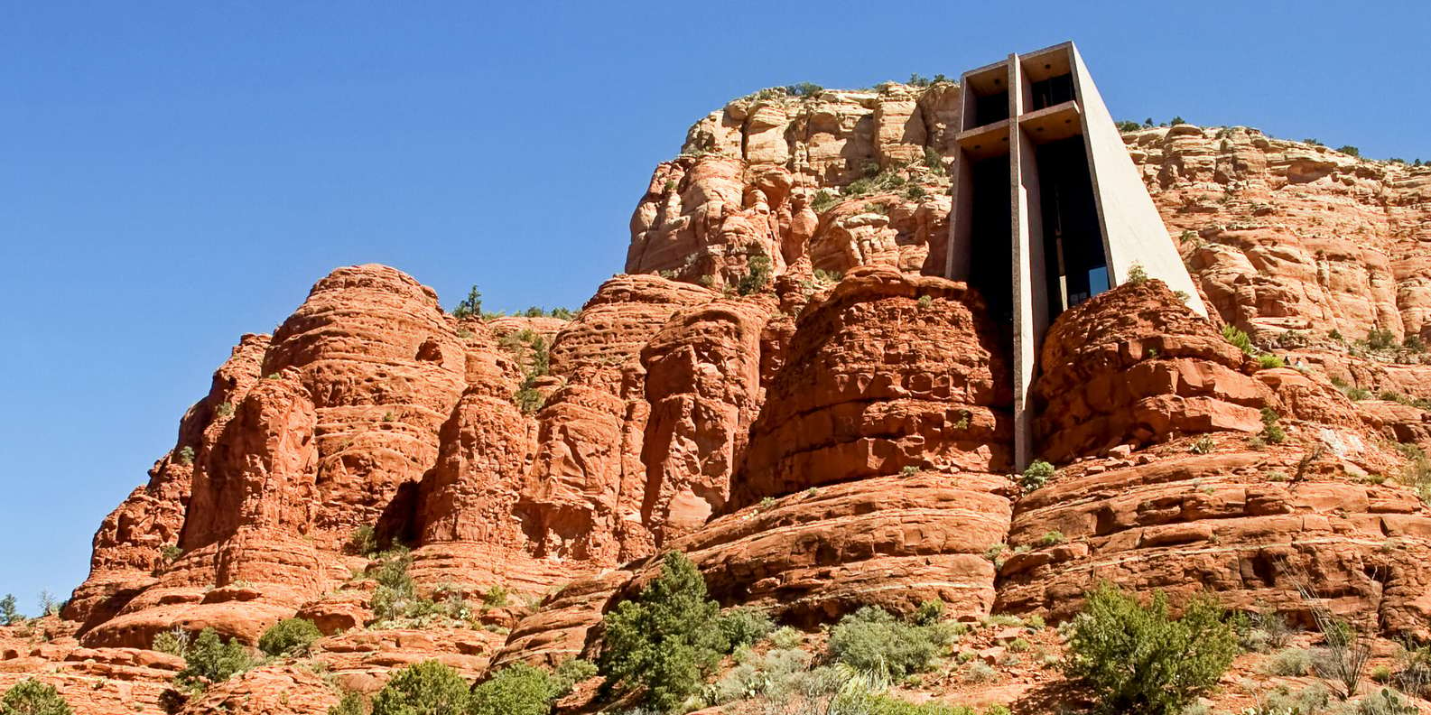
The Chapel of the Holy Cross is a concrete-and-steel church built directly into the red rock face above Sedona, Arizona. Designed by Marguerite Brunswig Staude, the 250-foot cross cantilevers over the canyon. Entry is free and open outside of scheduled mass times.
| Details | Info | Insider Note |
| Location | 336 AZ-179, Sedona, directly on the main corridor | Walk from many AZ-179 hotels, parking is free on site |
| Entry Fee | Free to enter | Individual galleries and restaurants charge separately |
| Best Time | Weekday mornings or weekend evenings | Midday Saturday is the peak crowd; avoid it if possible |
| Time Needed | 1 to 3 hours | – |
| Best For | Couples, architecture lovers, spiritual visitors, non-hikers | Mystic Vista Trail starts just north of the parking area |
| Difficulty | Easy | Cobblestone surface, limited accessibility in some areas |
The Part Most People Miss
I did exactly what most people do the first time. I slowed down on 179, took a photo through the window, and kept driving. On the second visit, I actually parked and walked up. The rear patio stopped me completely. The whole landscape opens northwest toward Airport Mesa, a direction the approach entirely hides. Marguerite Brunswig Staude built a 250-foot concrete cross cantilevered over the canyon, and somehow it feels quiet rather than dramatic. The patio behind it is worth five minutes nobody seems to budget for.
Inside and Around the Building
Parking is on Chapel Road, about 200 feet below the entrance. The walkway is paved and accessible. Inside, the chapel holds around 30 people. Anyone can enter outside of Mass. There is a small gift shop and votive candles. The canyon walls and concrete absorb sound, making the interior unusually quiet.
When to Visit and What to Know
- Mass times are posted at chapeloftheholycross.com; visiting outside of mass gives you the space to be quiet.
- The Mystic Vista Trail begins just north of the chapel parking area and offers a ridge hike with no crowds and views that rival Airport Mesa.
- Parking fills quickly on weekends; the overflow is along Chapel Road, but the walk adds 5 minutes.
Getting There
Take Route 179 South from the Y intersection for one mile, make a left onto Morgan Road, and another left onto Chapel Road. This will be approximately 0.5 miles of curvy road traveling up the face of the mesa.
Do Not Leave Without Doing This
- Do not arrive expecting a typical church experience and leave disappointed: the architecture is the point.
- Do not skip the outdoor terrace on the back side of the building; it takes an extra 60 seconds and offers an entirely different view.
Google Maps | Chapel of the Holy Cross |
6. Airport Mesa Vortex: Easiest Sedona Vortex Site with Best Sunset Views
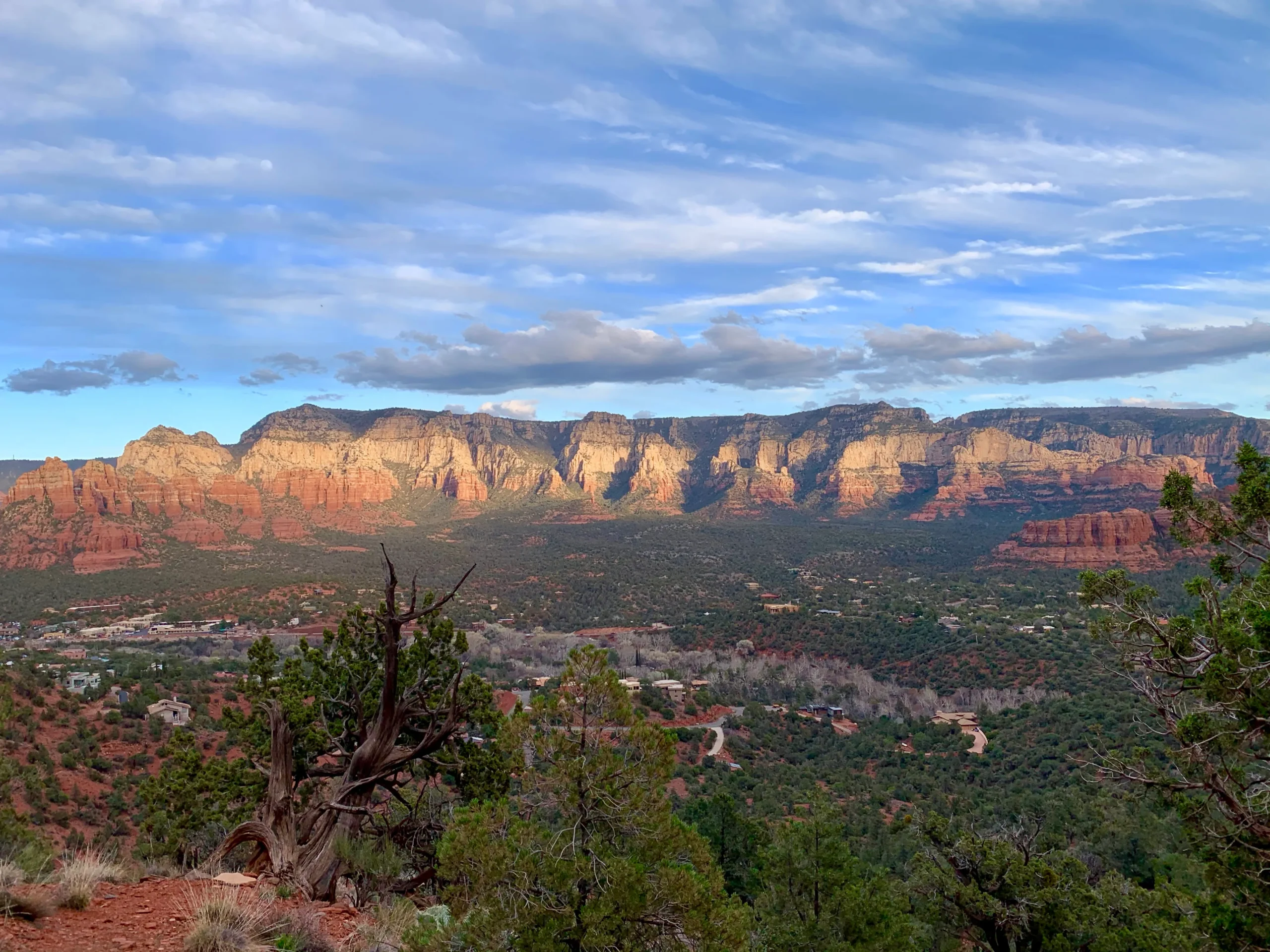
Airport Mesa is one of four recognized Sedona vortex sites and the easiest to reach from downtown. The 3.5-mile loop trail circles the mesa at 4,800 feet with eye-level views of Cathedral Rock, Courthouse Butte, Bell Rock, and the Mogollon Rim. Sunset here is exceptional.
| Details | Info | Insider Note |
| Location | Airport Road, 1 mile west of AZ-89A junction | Turn left off 89A, pullout is 1.1 miles up on the left |
| Entry Fee | Free | No Red Rock Pass required at this pullout |
| Best Time | 45 to 70 minutes before sunset | Pullout fills 45 min before sunset on weekends |
| Time Needed | 30 minutes to 1 hour | Full 3.5-mile loop adds significant time |
| Best For | Sunset, vortex seekers, non-hikers, couples | Shortest walk to a vortex site in Sedona |
| Difficulty | Easy | Short rocky walk, suitable for most mobility levels |
What the Sunset Actually Delivers
I counted five distinct color shifts the evening I stayed through the full sunset. The rock goes from red to amber to something close to purple before the light drops completely, and it happens faster than you expect. The junipers near the vortex marker are the strangest part. The trunks spiral outward rather than growing straight, and you notice it immediately when someone points it out. Believe what you want about why that happens. The trees are genuinely strange either way.
The Trail and the Vortex Area
The main Airport Road pullout holds about 30 cars. The trail climbs a mild switchback to the mesa edge, then loops along the rim. The full loop is 3.5 miles. The out-and-back to the first overlook is 1 mile. At any hour, expect a mix of yoga practitioners, crystal holders, and regular hikers on the same trail.
Timing It Right
- Arrive 70 minutes before sunset to get parking and reach the overlook without rushing.
- The Airport Road pullout fills by 45 minutes before sunset; the secondary pullout is 0.3 miles further down Airport Road.
- Bring a headlamp: the descent in post-sunset dusk on the rocky trail is slow without one.
Navigation Details
From the Y intersection, go west on 89A for half a mile and then turn left onto Airport Road. The main parking lot is 1.1 miles away on the left-hand side.
Two Things That Catch People Off Guard
- Do not attempt the loop trail in sandals: the trail surface is angular basalt in sections with a real trip hazard.
- Do not skip the actual vortex marker just past the first overlook; most people stop at the overlook and miss the most visually distinctive juniper stand.
Google Maps | Airport Mesa Vortex |
7. Tlaquepaque Arts Village: Best Shopping and Local Art in Sedona

Tlaquepaque Arts and Shopping Village in Sedona is a 1970s-built open-air arts complex with over 40 galleries, studios, and restaurants set around shaded courtyards. It is where serious Sedona artists sell work unavailable anywhere else in Arizona.
| Details | Info | Insider Note |
| Location | SR-179, 0.4 miles south of the Y junction | Free Parking in the lot directly off SR-179 |
| Entry Fee | Free to enter | Individual galleries and restaurants charge separately |
| Best Time | Weekday mornings or weekend afternoons | Midday Saturday is peak crowd, avoid if possible |
| Time Needed | 2 to 3 hours | – |
| Best For | Art buyers, couples, culture seekers, non-hikers | Over 40 galleries, most owner-operated |
| Difficulty | Easy | Cobblestone paths, fully walkable |
Why It Is Not Just Shopping
I walked into Kuivato Glass Gallery, not planning to spend money, and left having spent money. The glass is made in a local studio and sold nowhere online, which is either a sales tactic or the truth, but the work is good enough that it does not matter. The Navajo taco at El Rincon is the other reason to come. I missed it on a Monday and felt the specific regret of a preventable mistake. Book the table before you arrive.
How the Village Is Laid Out
The village is a series of linked courtyards that feel private even when busy. The artists themselves run galleries. Conversations go deep if you allow them to. The Sedona Arts Festival is held here annually. Parking is in the lot directly off SR-179.
What to Know Before You Go
- El Rincon is closed on Mondays; plan accordingly if you want the Navajo taco.
- The back courtyard near the creek is the quietest; galleries there include some of the village’s oldest tenants.
- Ask any gallery owner which studio is newest to the village; the recent additions rotate, and locals know.
Navigation Details
Found on SR-179, 0.4 miles south of the Y-junction, and located on a lot adjacent to SR-179. This is a Sedona Trolley stop.
The Mistake Almost Everyone Makes
- Do not confuse Tlaquepaque with the uptown shops on 89A; the quality and experience are completely different.
- Do not rush through: the village is designed for slow exploration, and the galleries are not browsing-hostile.
Google Maps | Tlaquepaque Arts Village |
8. Honanki Heritage Site: Ancient Sinagua Cliff Dwellings Near Sedona, Arizona

Honanki Heritage Site is a 13th-century Sinagua cliff dwelling 18 miles west of Sedona off Forest Road 525. The multi-story ruins include rock art from three distinct cultures: Sinagua, Yavapai, and Apache, layered on the same canyon wall across centuries.
| Details | Info | Insider Note |
| Location | Forest Road 525, Red Canyon Road, 10 miles west of Sedona | High-clearance vehicle recommended, standard cars can manage slowly |
| Entry Fee | $3 per person | Collected on-site by the heritage site volunteer guide |
| Best Time | Weekday mornings | The site is often empty before 10 am on weekdays |
| Time Needed | 1 to 1.5 hours | – |
| Best For | History, archaeology, photography, solitude | – |
| Difficulty | Easy | Flat walk of about 200 yards from the parking to the main alcove |
What Makes This Different From Other Ruins
The volunteer guide at Honanki pointed to a section of the wall and showed me exactly where the Sinagua imagery ends, and the Yavapai work begins, painted on the same surface centuries apart. That is the thing no photograph prepares you for. It is not one culture’s site. Three separate people looked at the same canyon wall across hundreds of years and decided it was worth marking. Standing in front of that overlap does something a museum exhibit cannot replicate.
The Drive Out and What You Find
Getting there requires 10 miles of graded dirt road on Red Canyon Road. Most passenger cars handle it fine in dry conditions. A Forest Service volunteer is usually on site. The ruins sit beneath rock overhangs, about 400 feet from the parking area along a flat, sandy path.
Logistics Worth Knowing
- Call the Red Rock Ranger District at (928) 203-7500 before going to confirm road conditions.
- Bring a $5 bill for the self-pay envelope; there is no card reader at the site.
- The morning light hits the cliff face directly between 9 and 11 AM, illuminating the pictographs better than midday light does.
Navigation Details
From 89A west of Sedona, head south on Dry Creek Road and then turn right onto Boynton Pass Road. Take Boynton Pass Road until you reach Red Canyon Road, where the directions will be marked. The entire drive from 89A takes approximately 20 to 25 minutes.
One Rule That Is Taken Seriously
- Do not attempt the road in a rental car after rain: the clay surface becomes deeply rutted, and the liability situation is uncomfortable.
- Do not touch the pictographs: skin oils cause irreversible damage to the pigment, and this is taken seriously by site volunteers.
Google Maps | Honanki Heritage Site |
9. Oak Creek Canyon Scenic Drive: Best Road Trip Near Sedona with Fall Foliage

Oak Creek Canyon Scenic Drive follows Highway 89A for 16 miles north of Sedona toward Flagstaff. The road descends 2,500 feet from the Mogollon Rim through sheer red and white canyon walls. October cottonwood color makes this one of Arizona’s best fall foliage drives.
| Details | Info | Insider Note |
| Location | Highway 89A north from Sedona toward Flagstaff | Drive begins immediately north of the Y junction |
| Entry Fee | Free | Some pullouts require Red Rock Pass: $5/day |
| Best Time | Morning driving north, afternoon driving south | Fall foliage peaks last two weeks of October |
| Time Needed | 1 hour driving, 3 to 4 hours with stops | – |
| Best For | Scenic drives, fall foliage, non-hikers, families | One of Arizona’s designated scenic byways |
| Difficulty | None / Standard road, no off-road required | – |
Why the Drive Itself Is the Point
The canyon drops 2,500 feet over 16 miles from the Mogollon Rim into Sedona. The road was blasted into the cliffside in the early 1910s and has nowhere logical to go, yet it does. The overlook at the rim gives you a top-down view of the entire canyon that looks nothing like the drive up. Most people skip it. Do not.
What to Stop For
Pullout signs are clearly marked along the drive. Grasshopper Point, a creek swimming area, is 2 miles north of Sedona on 89A with a $10 summer entry fee. The Bootlegger campground at mile 9 provides access to the creek without requiring an overnight stay. The road narrows noticeably past the 7-mile mark.
Getting the Most Out of the Route
- The best fall color window is typically the last two weeks of October; the Coconino National Forest posts foliage updates.
- Driving north in the morning puts the canyon walls in the sun on your right; driving south in the afternoon reverses this, and both work for photography.
- The entire drive to the rim and back is feasible in a half-day trip combined with a Flagstaff lunch.
The Route
From the fork in Sedona, drive northward along 89A to reach the canyon. As you can see, there are no breaks in the canyon formations until you reach Flagstaff.
Two Things Most People Get Wrong
- Do not stop in the road at overlooks; the canyon road is narrow and has two lanes; use designated pullouts only.
- Do not skip the drive south (back toward Sedona) from the rim overlook: the downward perspective is entirely different.
Google Maps | Oak Creek Canyon Scenic Drive |
10. Red Rock Crossing at Crescent Moon Ranch: Best Photography Spot in Sedona
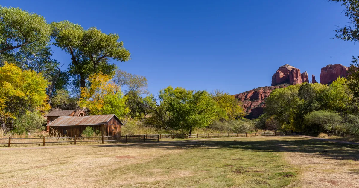
Red Rock Crossing at Crescent Moon Ranch is the most photographed location in Sedona, Arizona. At sunrise, Cathedral Rock reflects in Oak Creek against a backdrop of cottonwood trees. Water shoes and early arrival before 8 AM are both non-negotiable here.
| Details | Info | Insider Note |
| Location | 1 Crescent Moon Ranch Road, off Upper Red Rock Loop Road | Do not confuse with the Back O’ Beyond Cathedral Rock trailhead |
| Entry Fee | $10 per vehicle | Cash and card accepted at the booth |
| Best Time | Sunrise to 8 AM for reflection photography | Wind breaks the water’s surface after mid-morning |
| Time Needed | 1 to 2 hours | – |
| Best For | Photography, picnics, couples, non-hikers | Picnic tables and creek access throughout the property |
| Difficulty | Easy | Flat walking on packed dirt paths to the creek’s edge |
Beyond the Famous Shot
The official name is Crescent Moon Picnic Area. Beyond the Cathedral Rock reflection shot, the park has a creek trail, a former farmhouse site, and several swimming spots along Oak Creek. Most visitors arrive for one thing and stay longer.
The Creek and What Else Is Here
Enter via Red Rock Loop Drive and pay at the booth. A short trail leads to the creek. In late summer and fall, water is ankle-deep and easy to cross. In spring, snowmelt raises the level enough that wading is not safe.
Timing and Entry Notes
- The best reflection light is within 30 minutes of sunrise: arrive before the sun clears the canyon walls.
- Water shoes beat sandals here; the creek bottom is smooth rock and rounded pebbles, walkable but cold.
- The $10 fee is payable by cash or card at the gate; arriving before the gate opens (typically 8 AM) sometimes allows free parking on the road, though rangers have tightened enforcement.
Navigation Details
From the fork, continue on 89A for 1.5 miles before turning onto Upper Red Rock Loop Road to the left. The entrance to the park is 1.7 miles ahead on your right.
What Kills the Photo
- Do not attempt the creek crossing in sandals with no straps: the current, even at low flow, is enough to pull off a flip-flop.
- Do not visit at midday in summer: the reflection disappears when the sun is directly overhead, and the park becomes very hot with limited shade.
Google Maps | Red Rock |
11. Soldier Pass Trail: Best Intermediate Hike in Sedona with Sinkholes and Rock Pools

Soldier Pass Trail is a four-mile moderate hike in northwest Sedona that passes the Devil’s Kitchen sinkhole, a natural arch, and the Seven Sacred Pools carved into red sandstone. It is one of the most geologically varied trails in the Coconino National Forest.
| Details | Info | Insider Note |
| Location | Soldier Pass Road, northwest Sedona | Use the Posse Grounds shuttle on weekends; street parking is enforced |
| Entry Fee | Free | Red Rock Pass is not required at this trailhead |
| Best Time | Before 8 AM or after 4 PM | Trailhead lot holds only 15 cars, fills by 8 AM on weekends |
| Time Needed | 2 to 3 hours | – |
| Best For | Geology, photography, moderate hikers, solitude | Less visited than Devil’s Bridge despite comparable drama |
| Difficulty | Moderate | Rocky terrain, some scrambling near the sinkhole rim |
Start at the Sinkhole, Not the Pools
Devil’s Kitchen Sinkhole sits about half a mile in. It is a 100-foot-deep collapse formed when a limestone cavern caved in in 1880. A photograph of the event is on display at the Sedona Heritage Museum. Most hikers walk straight past it toward the pools. Stop here first. The sinkhole is what makes the rest of the hike make geological sense.
What the Trail Covers
The trailhead lot holds about 15 cars and fills by 8 AM on weekends. The hike starts easy, passes the sinkhole overlook, moves through a narrow rock canyon, and ends at the Seven Sacred Pools, basins cut into red sandstone by centuries of water. The return on the same trail takes about 40 minutes.
Parking and Shuttle Notes
- The City of Sedona runs a free shuttle to Soldier Pass from the Posse Grounds parking area on Posse Grounds Road; check SedonaShuttle.com for the current schedule.
- Bring trekking poles: the descent from the high bench to the pools is steep and loose in dry conditions.
- The pools hold water only seasonally; the late monsoon season (September) is the best time to find them filled.
Navigation Details
Drive out of 89A onto Soldier Pass Road, located at the junction of Jordan Road. Parking for the trailhead is available at the end of the road. Taking the shuttle from Posse Grounds is a more consistent route on weekends.
The One Thing People Walk Past
- Do not pass the Devil’s Kitchen without stopping at the viewpoint: it is 30 seconds off the trail and completely changes the geological context of the hike.
- Do not rely on the parking area on weekends: the shuttle is faster and eliminates the stress of circling.
Google Maps | Soldier Pass Trail |
12. Sedona Arts Center: Hidden Cultural Gem in Uptown Sedona

Sedona Arts Center on Art Barn Road has operated as a working nonprofit arts community since 1958. Monthly exhibitions feature local artists who show nowhere else in Sedona. The permanent collection includes early 1900s landscape paintings of Oak Creek Canyon before tourism arrived.
| Details | Info | Insider Note |
| Location | 15 Art Barn Road, Uptown Sedona, off AZ-89A | One block north of 89 A, easy to miss from the main road |
| Entry Fee | Free to enter | Classes and workshops are charged separately |
| Best Time | Tuesday through Saturday, 10 AM to 5 PM | Closed Sunday and Monday |
| Time Needed | 45 minutes to 1.5 hours | – |
| Best For | Art buyers, cultural visitors, rainy days | The monthly exhibition rotates local work regularly |
| Difficulty | Easy | Fully accessible building |
What the Permanent Collection Shows You
The Arts Center rotates exhibitions every month, and the artists showing here do not sell their work anywhere else in Sedona. There is also a collection of paintings from the early 1900s showing Oak Creek Canyon before the roads and hotels arrived. Standing in front of them, then walking outside to the same view, is a quietly unsettling experience. The canyon looks the same. That is the point.
The Space and How It Works
The main structure is an adobe building converted into a gallery and located on a side road one block north of 89A. Gallery exhibitions change periodically, while experimental exhibitions are held at the project room. Center staff members usually work at the arts center and know the artists currently featured.
Hours and What to Ask
- Check sedonaartscenter.org for opening receptions, which are free and heavily attended by local artists.
- Ask to see the permanent collection storage if you have a particular interest in Sedona’s historical landscapes.
Navigation Details
From uptown Sedona on 89A, turn north on Art Barn Road. The Arts Center is 100 feet on the left.
Do Not Confuse It With the 89A Galleries
- Do not confuse this with the commercial galleries on 89A; the Arts Center is a nonprofit organization with no sales pressure.
Google Maps | Sedona Arts Center |
13. Palatki Heritage Site: Best-Preserved Sinagua Ruins and Pictographs Near Sedona

Palatki Heritage Site contains some of the best-preserved Sinagua cliff dwellings and pictograph panels near Sedona, Arizona. Two separate trails lead to the ruins and the Blue Caves rock art panels. Reservation through the Red Rock Ranger District is required.
| Details | Info | Insider Note |
| Location | Forest Road 795, via Boynton Pass Road, 16 miles from Sedona | Dirt road, generally passable by passenger vehicle in dry conditions |
| Entry Fee | $5 per person | Call (928) 282-3854 to reserve in advance |
| Best Time | Weekday mornings, Tuesday through Saturday only | Slots fill by midweek for the following weekend |
| Time Needed | 2 hours | – |
| Best For | History, archaeology, pictographs, solitude | Two separate trails: ruins and pictograph panels |
| Difficulty | Easy | Flat sandy trail, about 400 yards from the parking |
What the Blue Caves Panels Are Actually Like
Our guide had been walking this site for over a decade, and it showed within the first two minutes. She did not read from a script. She pointed at specific figures and explained what made them Sinagua versus what came later, and why certain panels face the direction they do. The dwelling itself sits under a limestone overhang so large that you do not notice the ceiling until you look up. Two levels of structure still standing after 700 years. The Blue Caves panels are a short, separate walk and are worth at least as much time as the ruins.
Two Trails, One Site
Call (928) 282-3854 to book in advance. No drop-ins once the daily limit is reached. Visitor numbers are capped for conservation. Two short trails leave from the parking area: one to the ruins, one to the pictograph panels.
The Reservation and Road Conditions
- Call Monday morning to reserve the following weekend slots; they fill by midweek.
- Photography of the pictograph panels is permitted without flash; the light is best before 11 AM, when shadows fall across the panels.
- The dirt road to Palatki is generally accessible to passenger vehicles; check with the ranger district after rain.
Navigation Details
Starting from the western part of Sedona along Highway 89A, drive south on Dry Creek Road, then take the left turn on Boynton Pass Road. Signs will guide you towards Forest Road 795.
If You Show Up Without a Booking
- Do not show up without a reservation: the site actively turns people away, and the road is not short enough to make the trip casual.
- Do not leave the marked trails: cultural artifacts are present throughout the site, and off-trail movement damages the record.
Google Maps | Palatki Heritage Site |
14. Verde Valley Wine Trail: Best Day Trip from Sedona for Wine and Local Food

The Verde Valley Wine Trail runs through Cornville, Clarkdale, and Cottonwood, 15 to 30 minutes south of Sedona along Highway 89A. Arizona’s fastest-growing wine region produces Grenache, Syrah, and Mourvedre from the high-desert floor of the Verde River Valley.
| Details | Info | Insider Note |
| Location | Page Springs Road and Route 89A Cornville Cottonwood | Page Springs Road turns right off 89A, 12 miles from the Y junction |
| Entry Fee | Varies by winery | Tasting typically costs $15 to $20 for five to seven pours |
| Best Time | Weekday mornings in summer, any time in spring and fall | September to October is harvest season with vineyard tours |
| Time Needed | Half to full day | – |
| Best For | Wine lovers, couples, and day trippers from Sedona | Food trucks at most spots on weekends |
| Difficulty | Easy | Flat vineyard walks, no trail required |
Why Arizona Wine Is Worth Taking Seriously
I skipped this on the first trip because Arizona wine sounded unconvincing. That was a mistake. The patio at Page Spring Cellars overlooks Oak Creek through a line of cottonwoods, and the Grenache they were pouring that afternoon was better than I had any reason to expect. Alcantara sits inside a horseshoe bend of the Verde River. The setting alone is worth the drive down from Sedona.
How the Trail Is Laid Out
Most vineyards cluster along Page Springs Road and Route 89A between Cornville and Cottonwood. Three or four in a single day is realistic. Tastings run $15 to $20 for five to seven pours. Food trucks appear at most spots on weekends. Old Town Cottonwood has a walkable wine district on Main Street.
Picking the Right Wineries
- Designate a driver or use rideshare for the Cottonwood end of the trail; the distance back to Sedona on a winding road is not casual after four tastings.
- Arizona Stronghold Vineyards in Cottonwood and Merkin Vineyards (Maynard Keenan of Tool’s project) are the most visited; book ahead for weekend tastings.
- September through October is harvest, and many wineries offer vineyard tours during crush.
Getting Out of Sedona
From Sedona, take 89A southwest toward Cottonwood. Page Springs Road turns right off 89A about 12 miles from the Y junction.
The Mistake That Ruins the Drive Back
- Do not treat this as an afterthought: the wine quality in this AVA competes with California Rhone producers at lower price points, and visitors who skip it because “Arizona wine” sounds implausible miss one of the Southwest’s genuine culinary assets.
Google Maps | Verde Valley Wine Trail |
15. Hot Air Balloon Ride Over Sedona: Aerial Views at Sunrise from the Mogollon Rim

A hot air balloon ride over Sedona launches from the Village of Oak Creek before dawn and reaches 1,500 feet as the sun clears the Mogollon Rim. Northern Light Balloon Expeditions and Red Rock Balloon Adventures both use FAA-certified pilots. Flights run year-round.
| Details | Info | Insider Note |
| Location | Village of Oak Creek staging area; 7 miles south of the Y junction on SR-179 | Operators provide an exact meeting point at booking |
| Entry Fee | $180 to $230 per person | Book directly with the operator, not a third-party aggregator |
| Best Time | Year-round, spring fills fastest | Book at least two weeks ahead for weekend dates |
| Time Needed | 3 to 4 hours, including launch and landing | The flight itself is 60 to 75 minutes |
| Best For | Couples, aerial views, romance, first-time balloon riders | – |
| Difficulty | None | Standing only through the flight, no physical requirement |
What the Landing Feels Like
The burner cuts out, and the silence is immediate and total. That is the moment nobody mentions in the booking description. You are at 1,500 feet with the Mogollon Rim behind you and Sedona below, and it is completely quiet. The landing is gentler than I expected. Afterward, there is champagne in the field while the balloon collapses behind the crew, and at 7 AM, slightly cold and still adjusting to being on the ground, it is a stranger and better ending than anything I had pictured.
The Logistics of the Morning
Pickup is at the staging area near the Village of Oak Creek. A ground crew vehicle tracks the balloon and collects passengers at the landing site, which shifts with the wind. Baskets hold 6 to 12 people, depending on balloon size. There are no seats. You stand for the entire flight.
Booking and What to Wear
- Book at least two weeks ahead for weekend dates; flights run year-round and fill up months in advance in spring.
- Dress in layers: the air at 1,500 feet before sunrise is 15-20 degrees colder than ground temperature
- The burner is loud at ignition and intermittent in flight; it is not the silent drift most people imagine.
Getting to the Staging Area
Operators provide specific meeting-point instructions at the time of booking. The Village of Oak Creek staging area is about 7 miles south of the Y junction on SR-179.
Two Things to Ignore and One to Trust
- Do not book through a third-party aggregator for balloon rides; go directly to the operator for accurate availability and to communicate directly with the pilot about conditions.
- Do not cancel for cloud cover alone: balloon pilots read weather more precisely than consumer apps; trust the operator’s weather call.
Google Maps | Hot Air Balloon Ride Over Sedona |
Where to Stay in Sedona
Uptown Sedona (89A corridor)
The walkable area around Tlaquepaque and the trailhead shuttle centers. This includes both the boutique hotel L’Auberge de Sedona and chain hotels. You will need to budget between $250 and $400 per night for a room. All attractions are a short ten-minute drive away at most. The official Visit Sedona site lists current hotel availability, events, and trail conditions across all four neighborhoods.
Village of Oak Creek
Just six miles south of Highway 179, there are better prices and the home base for both the Bell Rock and Cathedral Rock hikes without entering Sedona’s traffic center. This area has mainly chain hotels and vacation rental units. You should budget around $120 to $180 a day for a room.
West Sedona
Residential style with short-term rental property on Dry Creek Road and nearby streets. Ideal for family or group trips seeking larger accommodations. Located at the Dry Creek trailhead area. The nightly rate would be between $200 and $350 for a full house with a capacity of four to six guests.
Oak Creek Canyon
If you opt to remain in the canyon and stay in hotels such as Garland’s Lodge (which opens bookings 13 months before the date), then you will be staying among some of the most spectacular natural sites just a 15-minute drive from downtown. In-canyon accommodation costs range from $400 to $800 per night.
Getting Around Sedona
| Transport | Cost | Best Used For | Insider Notes |
| Personal Vehicle | Gas + $3-$10 parking | All trailheads, day trips | Park at the shuttle hubs on weekends |
| Sedona Shuttle | Free (Select routes) | Boynton Canyon, Bell Rock, Cathedral Rock | Check SedonaShuttle.com for current schedules |
| Rideshare (Lyft/Uber) | $8-$20 per trip in town | Late night, wine trail, airport transfer | Availability drops significantly after 9 PM |
| Sedona Trolley | $12-$18 per tour | Tlaquepaque, uptown, Chapel of Holy Cross | Not a transit system, it operates as a guided tour |
| Bicycle | Rental $30-$50/day | Flat greenway routes, village of Oak Creek | Not practical for slickrock trailheads |
Current Sedona Shuttle routes, Park and Ride locations, and real-time schedules are listed at visitsedona.com/trip-planning/ground-transportation.
Many visitors combine Sedona with a broader Southwest loop. If you are flying into Las Vegas and driving south through Arizona, compare bus and other transportation options on our Las Vegas-to-Los Angeles route page before finalizing your itinerary.
Best Time to Visit Sedona
| Season | Weather | Crowds | Honest Verdict |
| March-May | 65-85°F, occasional wind | High to peak | Best overall conditions; book lodging 60+ days out |
| June-August | 90-105°F | Peak | Uncomfortable afternoons; go for sunrise hikes only |
| September-October | 70-85°F | Moderate | The best-kept secret: fall color in October is real |
| November-February | 40-65°F | Low | Cold mornings, clear skies, 30-50% lower hotel rates |
Day Trips from Sedona
Jerome
30 minutes southwest on Route 89A, Jerome is an old copper-mining town designed for vertical expansion because of its position atop Cleopatra Hill, overlooking the Verde Valley from 2,000 feet above. The Ghost City Inn B&B is located in a 1898 Victorian house, while the town’s main road features art galleries, wineries, and bakeries.
Montezuma Castle
Thirty minutes from Interstate 17, Exit 289, lies the Montezuma Castle National Monument, a 20-room cliff dwelling constructed by the Sinagua around 1100 AD. The castle’s integrity is remarkable enough to make Honanki and Palatki appear to be mere ruins. At only $10 per person, this attraction offers the best bang for your buck among Arizona national monuments.
Flagstaff
The town of Flagstaff, which lies 45 minutes away from Sedona on Route 89A, is at 7,000 feet above sea level and experiences temperatures that are 20 degrees cooler than Sedona during the summer season. The Museum of Northern Arizona, located at 3101 N. Fort Valley Road, houses the largest collections of Ancestral Puebloan ceramics and Navajo textiles in Arizona.
Planning to continue beyond Arizona? Our complete guide to tourist attractions in the USA covers the Grand Canyon, national parks, and other Southwest destinations worth adding to the same trip.
Where to Eat in Sedona
Elote Cafe (771 SR-179)
The esquites de maiz with crema, cotija, and chipotle on the cart at the table is the dish. Price is $16-18 for the appetizer that serves as an entree. Reservations not needed; cash and cards accepted; wait begins before 5 pm. The first time a waiter brings the corn cart and makes the food, the entire aroma of the restaurant changes.
Mariposa Latin Inspired Grill (700 W. Highway 89A)
The wood-fired grill is equipped to serve its Argentinian-inspired fare from the terrace, which faces the striking red rock formations straight west. The chimichurri ribeye goes for $48-$55. Reservations are necessary; make them at least one week in advance via their website on weekends. The bread with butter smoke comes even before you get comfortable at your table.
René at Tlaquepaque (336 SR-179, inside Tlaquepaque)
The oldest fine-dining restaurant in Sedona has been operating in the same courtyard since 1975. Rack of lamb with a pomegranate reduction costs $55-$65 and is their signature dish. The restaurant’s dining area is housed in an adobe structure with low ceilings and terracotta walls, serving not only as a dining area but also as an art gallery.
Closing
Sedona is one of those places where the landscape does the work and the visitor’s only job is not to rush it. The rock has been there for 300 million years, and it will be there after every tour bus leaves, after every Instagram post, after every crowded Saturday at Devil’s Bridge. The people who get the most out of it are the ones who drive out past the last trailhead at dusk and just sit with it for a few minutes before the light goes. That moment does not show up in any travel guide, and it does not cost a parking fee. It is just Sedona being Sedona, which is more than enough.
People Also Ask About Things to Do in Sedona
What are the best things to do in Sedona without hiking?
Tlaquepaque Arts Village, Airport Mesa vortex overlook, Oak Creek Canyon scenic drive, Crescent Moon Ranch picnic area, and a Pink Jeep tour cover the core Sedona experience with no trail time required.
What are the best free things to do in Sedona?
Airport Mesa vortex, Amitabha Stupa Peace Park, Bell Rock and Cathedral Rock trails, and the Oak Creek Canyon scenic drive are all free or require only the $5 Red Rock Pass for parking.
What are the best things to do in Sedona with kids?
Slide Rock State Park is the primary family activity. Crescent Moon Ranch creek wading works for younger children. Bell Rock Trail is manageable for kids aged 4 and up on the first half mile.
How many days do you need in Sedona?
Three days comfortably cover the core experience. Two days' work if you start early each morning. One day is enough to see two or three attractions, but not enough to understand why people come back.
Is Sedona worth visiting in summer?
Yes, with adjusted timing. Hike before 8 am, use Slide Rock in the afternoon, and avoid all midday outdoor activity. Monsoon storms from mid-July onward produce exceptional evening light on the rock.
What is the best hike in Sedona for beginners?
Bell Rock Trail. Wide, well-marked, flat approach, optional scramble, and views comparable to harder trails. West Fork Trail in Oak Creek Canyon is the best second option for shade and creek walking.
What are the Sedona vortex sites, and are they worth visiting?
The four sites are Airport Mesa, Cathedral Rock, Bell Rock, and Boynton Canyon. Visit them as scenic destinations with a spiritual bonus. Airport Mesa is easiest, Bell Rock is best for families, and Boynton Canyon is the most remote and quiet.
Is Sedona expensive?
Hotels run $140 to $400 per night, depending on location. Dinner averages $20 to $35 per person. The trails and parks cost $5 to $10 per day. Budget travelers focused on hiking and self-catering can manage $60 to $80 per person per day beyond accommodation costs.